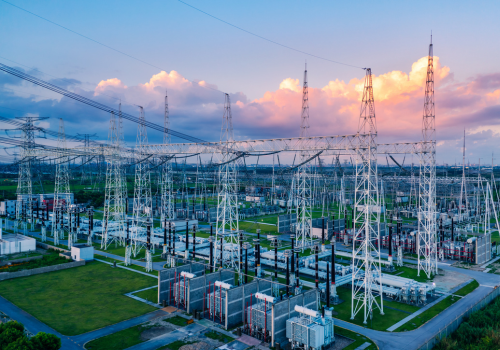
The amount of underground infrastructure required to serve a developed country is astounding. According to the Common Ground Alliance, there are more than 20 million miles of underground infrastructure—pipelines, cables, and wires. By contrast, the US National Highway System has a total length of about 160,000 miles, according to the Federal Highway Administration.
A lot of that infrastructure needs to be maintained or replaced. But, unlike a highway, you can’t see with it with your naked eyes. And traditionally, the industry had a set it and forget it attitude. Most times, underground infrastructure record-keeping was limited, leading to inaccurate and incomplete data.
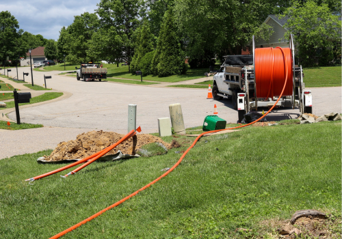
Underground utility owners and contractors have several options for locating underground utilities depending on the utility. These include electromagnetic, ground penetrating radar (GPR), cameras, and daylighting.
Is electromagnetic the best solution?
Electromagnetic utility locating is probably the most common method for locating a utility. Numerous utilities give off an electric current. Any wires and most metallic pipelines provide an electric current, which can be picked up with a locator.
Using the data provided by the locator, the surveyor can locate the utility, including how deep it is. “It’s always an estimated depth reading. The more round the electromagnetic field around the utility is, the more accurate the depth reading on your receiver,” says Tanner Peterson of C&S Solutions.
A utility locator can identify the location and depth of underground cable and wires, even when inside a conduit. Some have the capability of pinpointing breaks or faults in underground lines.
“You send a current down the line, and it will jump off at the line at the point of the fault,” says Peterson. “Fault locators help you pinpoint the location you’re losing current flow. Above ground, the surveyor follows arrows on a screen until they are standing directly above the fault area.”
If the utility isn’t conductive, such as plastic or clay, there are products you can introduce into the infrastructure that is conductive, so you can now send a signal down, and it will be picked up by the receiver.
For example, you can use a sonde, which is a stand-alone beacon, ranging from less than an inch to more than two inches in diameter. It can be attached to a duct rodder, which looks like a hose on a wheeled hose reel, except this “hose” is a lot more rigid than a hose, and can be pushed through a pipeline. The sonde can be picked up by an electromagnetic locator, so surveyors run a locator while the sonde is inside the pipeline. You can push the sonde up to 1,000 feet and detect it along its midpoints.
Locators provide underground utility data in real-time and the information can be saved for future use.
With some locators, you can export the data for geographic information system (GIS) mapping. “Utility and property owners are increasingly wanting to build digital maps of their underground property,” says Peterson. “This provides the data they need for future excavation, builds, and planning.”
You can also introduce a mobile camera into pipelines. With these remote-controlled mini machines, you can inspect the inside of pipelines.
“Manufacturers started making cameras self-levelling, so you never have to view images at awkward angles anymore,” says Peterson. “And images can now be shared via phone, so the customer can now see on their own phones what the camera sees.”
Cameras come equipped with a sonde, so you can then use a receiver to detect the sonde in the camera head. That way, you know exactly where to dig so you can repair the damaged pipe.
Ground penetrating radar can do it all
A locator that uses ground penetrating radar locates utilities by showing changes in the soil. A deviation from the standard reading indicates the possible location of a utility. It’s an excellent system for identifying differences in soil beneath the surface and at what depth. However, it's less reliable at finding utilities compared to electromagnetism when you are able to use an electromagnetic field to locate the utility. GPR works best in sandy soils and worst in clay soils.
If the utility isn’t conductive and you can’t introduce a conductor into the system, GPR is your best option.
Bringing underground utilities to light
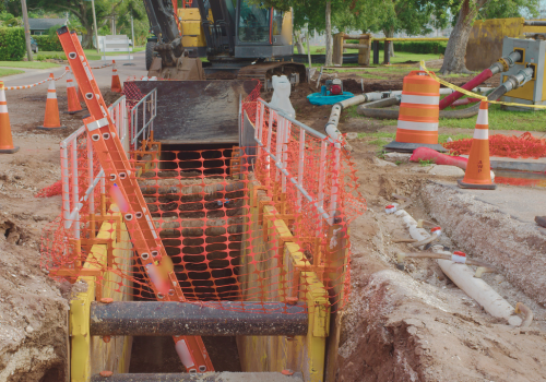
Electromagnetism and GPR are the only non-destructive methods of locating underground utilities. The only other way of locating equipment is to dig for it. When you uncover a utility, it’s called daylighting. Daylighting operations usually use a hydrovac truck, since an excavator can damage the utility. And this can result in a huge inconvenience to a large population who would be without water, or power, or Wi-Fi, or heat. And it could even be deadly to the operator it its a gas line.
Daylighting often takes longer and costs more than non-destructive forms of locating underground utilities, however, if you’re confident about the location and need to access that point of the infrastructure, then the excavation work is already complete.
Subscribe to The Utility Expo monthly newsletter to receive more industry insights like this.
Read Next
Pros - Cons of a Vacuum Excavator
Tips To Recruit And Retain Underground Utility Workers